


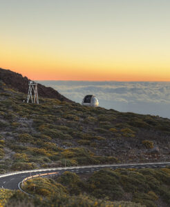
Roque de los Muchachos
Distance: approx. 1 hour
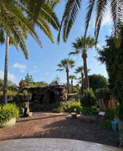
Parque Antonio Gómez Felipe
Distance: approx. 45 minutes
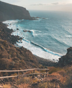
Playa de El Callejoncito
Distance: approx. 18 min. by car
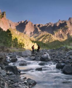
Caldera de Taburiente National Park
Distance: approx. 1 hour's drive to the start of the hike
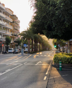
Los Llanos de Aridane
Distance: approx. 45 minutes by car
Mirador El Time
Distance: approx. 25 min. by car
Viewpoint in Tijarafe high above the Barranco de las Angustias gorge – with panoramic views over the Aridane valley to the Atlantic.
Santa Cruz de La Palma
Distance: approx. 1 hour by car
The island capital with its historic old town, colourful wooden balconies on the Avenida Marítima and a small town beach.
Tajogaite volcano
Distance: approx. 50 min. by car
The island's youngest volcano (2021 eruption). The crater can be visited on guided tours.
Los Tilos
Distance: approx. 1.5 hours by car
Biosphere reserve with pristine laurel forest in the north-east – ideal for hikes to springs and waterfalls.
Salinas de Fuencaliente
Distance: approx. 1 hr 15 min. by car
Sea salt works at the southern tip by the lighthouse, surrounded by black lava fields and young volcanoes.
Hike
Las Tricias – Cuevas de Buracas
approx. 6 km · easy · approx. 15 min. drive
Circular walk through a grove of old dragon trees to the Buracas caves with rock carvings by the original inhabitants.
Hike
Porís de Candelaria
short but steep · approx. 25 min. drive
Descent from Tijarafe to the "pirate bay": fishermen's houses built into a huge rock cave by the sea.
Hike
Pico Bejenado
approx. 12 km circular · moderate · approx. 50 min. drive
Summit hike to 1,854 m with one of the finest views into the Caldera de Taburiente.
Hike
Marcos y Cordero
approx. 14 km · moderate · start by taxi from Los Tilos
Through 13 water-channel tunnels to the Marcos and Cordero springs and on through the laurel forest to Los Tilos. Bring a torch and a rain jacket.
Hike
Ruta de los Volcanes
approx. 18 km · challenging · start at Refugio El Pilar
The classic hike along the volcanic ridge of the Cumbre Vieja – from crater to crater down to Fuencaliente.

Distance - approx. 1 hour away
Roque de los Muchachos
The Roque de los Muchachos Astrophysical Observatory in the municipality of Garafía lies in the summit area at an altitude of 2,426 m above sea level and is considered one of the best observatories in the world.
Thanks to La Palma's pitch-dark, cloudless skies, it is one of the most suitable places on earth for observing the stars all year round. But this area is much more than that.

Distance - approx. 45 minutes away
Parque Antonio Gómez Felipe
in Los Llanos de Aridane
Redesigned in 2010 by island artist Luis Morera, "El pequeño jardín botánico del parque municipal Antonio Gómez Felipe" – to give it its full name – lies south of the centre of Los Llanos de Aridane, on the right-hand side of the road to Puerto Naos. The park has three parts: at the bottom there are always domino players, in the middle a playground with futuristic play and fitness equipment, and at the top a relaxation area with 300 native, mostly endemic plants between bizarrely shaped lava rocks and mosaics.

Distance - approx. 18 min. by car
Playa de El Callejoncito
near Santo Domingo, Garafía
Approx. 18 minutes by car, followed by a short walk of about 20 minutes down to the beautiful cove.

Distance - approx. 1 hour's drive
Caldera de Taburiente National Park
Approx. 1 hour's drive to the start of the hike. Excursions to watch the night sky, trails leading through the open heart of the planet, bathing under a waterfall of colours… the list of possible activities is endless. But one thing is certain: if you want to uncover the secrets of the Caldera de Taburiente, you need to put on your hiking boots and climb skywards on one of the steep paths between monumental pine trees.

Distance - approx. 45 minutes away
Los Llanos de Aridane
Puerto Naos, one of the island's tourist centres, belongs to this municipality in the west. The beaches of Puerto Naos and Charco Verde are close by and highly recommended. Los Llanos de Aridane is also one of the starting points into the island's famous national park, the Caldera de Taburiente. Besides the popular plaza, the town centre offers many restaurants, bars and shops, and the old town has fine examples of secular and religious architecture.